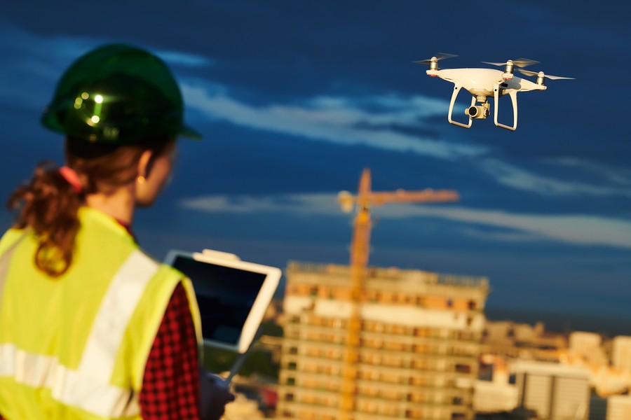
Construction sites today look nothing like they did ten, or even five, years ago. Workers carry smartphones, smartwatches, tablets, and other trendy gadgets designed to streamline communication and increase safety. But the real must-have on every modern construction site is an unmanned aerial vehicle (UAV), more commonly known as a drone.
The tiny airborne marvels are perfect worker bees for junior to senior level managers, safety engineers, inspectors, and surveyors looking to improve their processes.
Benefits of using drones in construction
Safety
The construction industry is high-risk. Employees have to navigate their way around scaffolding, scale rooftops, and enter confined spaces. Of course, you never wish to put your workers in the line of danger, but sometimes it’s necessary to get the job done.
But what if you didn’t always have to send someone into a risky situation? That’s where drones come in — they can travel places workers can’t (or shouldn’t). Clark Peterson of Skanska sums up the safety advantage this way: “Anything that we can do to eliminate a hazard where an employee can be injured through the use of technology, that’s great for me.”
Safe structure inspections
Scaling ladders, scaffoldings, and roofs is extremely dangerous for workers. In fact, falls cause nearly 400 construction deaths every year. Now imagine not having to send people high into the sky at all.
Drones can meticulously inspect structures like roofs, cell towers, wind turbines, and any other structure you’re building or working around. Additionally, you can send drones into confined spaces and areas that may be contaminated with hazardous materials, all without the risk of injury. Wouldn’t it be nice to hang up the Hazmat suit and respirator from time to time?
Potential hazard identification
Construction sites are full of unknowns. Terrain may shift after weather events or periods of heavy equipment traffic, existing structures may be unstable, or there may be power lines to contend with, all of which can be overlooked until you’re in the thick of things. So if you’re not entirely sure what kind of dangers exist on site, send in a drone to collect intel. You can either watch the grand tour via live stream, have the machine capture still photography, or collect high-definition video of the site. In any case, you can use a drone to easily identify potential hazards without coming in direct contact with them.
An eye in the sky during an emergency
Speaking of unknowns, sometimes emergencies like flooding, fires, or collapses occur on construction sites. In such cases, it’s not practical to send your workers into unsafe areas, but a drone can easily navigate in the skies above to give you a closer look at what’s going on.
Guaranteed ROI
Drones decrease the risk of worker injury, which in turn saves you time and money.
For example, one fall resulting in multiple physical injuries could cost you $154,872. A worker fatality could cost you $3 million or more. But just one $10K investment in a drone or drone services can easily save you from incurring these costs.
Efficiency
Short lead time
It takes virtually no time at all to launch a drone. A drone can be ready for takeoff in a matter of minutes as long as the weather cooperates and the pilot assures all FAA regulations have been met. There’s really no comparison between a drone flight and something like a helicopter fly-over service that can take weeks to book at a premium price.
Quick inspections
Large construction projects require huge time investments in walkthroughs and inspections. But with a drone, you can complete these inspections swiftly and without extra manpower. For example, one of TriMedia’s drones flies up to 26 MPH. That’d be like having Usain Bolt casually completing your inspections. Another one of our drones flies up to 45 MPH — just shy of a greyhound’s top speed.
Instant visual communication
Client communication is critical to business success. Mastering the art of talk improves customer retention, promotes transparency, and helps master productivity. And what better way to communicate project progress than to show the client the site in real time?
With access to a drone equipped with a high-definition video camera, you can schedule times to live stream a flyover of a project or, alternatively, regularly capture footage to send to clients later. Video creates a more emotional response than written reports and PowerPoint presentations, so expect plenty of “oohs!” and “ahhs!”
Internal process evaluations
Using the same strategy described above, you can keep workers from every department up to speed on project progress. Depending on the project, you could capture daily, weekly, or monthly visuals from drone cameras. Visuals are a powerful tool for inciting necessary change, so you don’t have to wait for a major setback to identify if any processes need to be reevaluated.
Different perspective
From the bird’s-eye view, you’ll see your work from a rare perspective. Photography and video from a drone might spark new ideas about your construction scheduling, resourcing, or how you can improve your site design.
Practicality and data accuracy
Aerial photos and video sourced from planes and helicopters are costly, and therefore not a viable option for smaller projects. Drones, on the other hand, are extremely versatile and can be flown at lower altitudes, making them an economic option for any project. Plus, drones can yield higher than traditional accuracies.
For example, our drones include high-resolution cameras — up to 38 MP — that allow us to generate dense point clouds, contouring, and aerial mapping with high precision through the process of photogrammetry. And when it’s time to analyze the data, with the combination of survey-grade instrumentation, drone-collected information can be georeferenced to both predefined and local site datums, guaranteeing that everyone is referencing identical data sets. The result is always a clear, accurate, and polished deliverable.
The bottom line
UAVs swiftly provide data with pinpoint accuracy, acting as an exceptional assistant for contractors or employees responsible for inspecting, mapping, and surveying construction sites throughout the project lifecycle. By using drones, you’re significantly cutting labor costs and also ensuring your end products are of unmatched quality.
—
Inspections, surveys, and mapping using drones
TriMedia owns the senseFly albris and the DJI Phantom 4 Pro. Our drones are insured in-house, so you have one less thing to worry about as you explore how this cutting-edge technology can make your processes more efficient, safe, and cost-effective.
Our pilots are highly experienced in the GIS, surveying, and environmental management fields, giving them the practical know-how to complete projects with high accuracy:
- Volumetrics surveys
- Structure inspections
- Maps/topography
- Damage assessments
- Digital elevation models
- Thermal imaging models
All our pilots have passed FAA Part 107 testing requirements to legally fly drones for commercial purposes.
Enter your email below to speak with one of our FAA certified pilots about how drones can improve your job site processes.