3 Things to Consider During Project Pre-Planning
You may know that utility locating keeps workers and the surrounding community safe. It also drives projects to stay on time and on budget. However, there are other things you may not know about this essential damage prevention service. Before you dig, learn how 8-1-1 and private utility locators can get your project off to a safe, strong start.
Here are three things you should know about utility locating before breaking ground.
1. Call 8-1-1 for digging on public property.
Free, state-mandated 8-1-1 is an essential service, but it’s limited. 8-1-1 locators can only locate utilities on public land; they are not authorized to measure on private property.
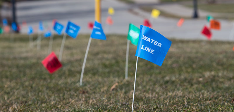
8-1-1 deliverables are also limited. 8-1-1 locators will paint lines and/or place flags to mark the approximate location of underground public lines and provide a list of possible utility owners within your work area. However, 8-1-1 does not have the technology to collect information from multiple sources.
A private locator, however, can compile data from 8-1-1, prior construction drawings, old building plans, and their own findings and incorporate it all into a field sketch or map.
Since about 65% of all utilities are on private property, most projects can benefit from the services of a private utility locator to fill the gaps.
2. Private locators with greater expertise and more advanced technology can produce more accurate and detailed work.
A private utility locator with advanced training and technology can produce more detailed deliverables, like digital maps, which help reduce mistakes and costly delays that result from inaccurate locates. If a locator misses a buried line due to limited technology or training, or a surface marker that’s been removed, there is a far greater chance of damage, injury, and construction delay.
PHMSA and CGA best practices require a minimum amount of training, most often limited to a one-day to weeklong course. Look for locators with Operator Qualified (OQ) staff who undergo annual competency verification examinations or audits. OQ locators should have training and experience with critical tasks such as excavation safety and four-way sweep methodology, which uses electronic transmitters and receivers to locate, trace, and map buried facilities. Locators perform four or more “sweeps” at different angles for maximum accuracy.
Advanced technology means more accurate locates, more data, and more precise results. For example, many electromagnetic (EM) locators have a single antenna, but more recent equipment has dual 3D antennas that greatly improve accuracy. Combined with the most current locating equipment, GIS technologies can capture and store clean, concise data that is verifiable and repeatable, so you can use it for future project planning.
Talk with your utility locator during project pre-planning about their equipment and technology, and don’t hesitate to ask questions about their capabilities and the data you can expect to receive. For example, deciding which locating method is best for your project in terms of data requirements and project timeline should be informed by understanding the differences between Electromagnetic location (which uses electrical current flows to identify buried lines) and Ground Penetrating Radar (which detects ground disturbances rather than the physical utilities). Your utility locator should be able to explain the advantages and limitations as they relate to your project and deliverables.
3. More in-depth deliverables can save you time and money — even years later.
There are multiple levels of utility locating deliverables, from the surface markers that 8-1-1 provides (see photo above), to GPS, GIS, and aerial mapping. Expert locators with up-to-date technology are able to collect precise, thorough, high-quality field data.
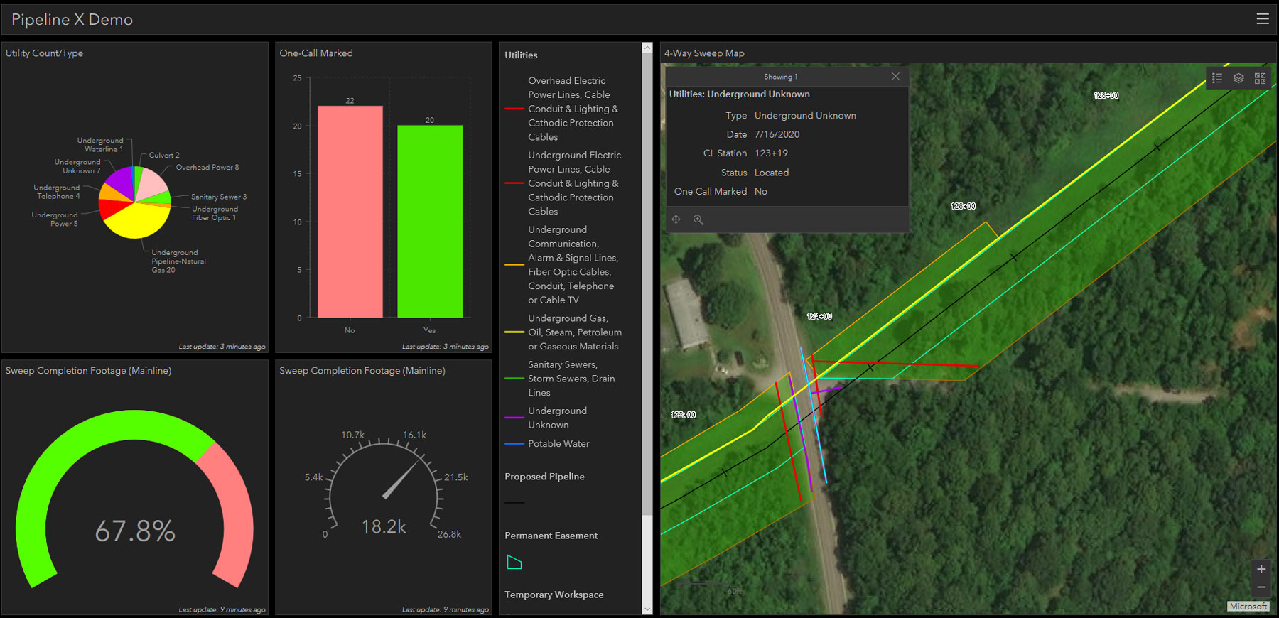
4-way sweep map showing the different utilities found for a project.
A GIS map of utility locations based on your project layout may be the most useful deliverable, since it provides information you can share with your team, your client, and other project stakeholders. Locators can use GIS systems to collect and interpret new data and combine it with existing client data to create a comprehensive map.
If weather or construction destroys the original field markers, or if a builder wants to add on, locators can use GIS mapping to repeat exact location marking within an inch or two — even years later.
Utility locating is an essential part of a establishing a strong safety culture for your project. Calling 8-1-1 and conferring with a utility locator service early in the project planning phase helps prevent damage and saves time and money.
TriMedia has a large pool of expert employees and partners with in-depth utility locating training and advanced technology that deliver accurate, high-quality field data.
From a backyard pool to a multi-state pipeline project, TriMedia can quickly scale our staffing to meet your project needs. Have questions about utility locating? Contact our experts, and we’ll get you answers.