“Good fences make good neighbors.” This proverb exists in cultures throughout the world, and for good reason: humans have been arguing over — and altering — land boundaries since the beginning of time.
This is why, when it comes to wetlands, knowing their exact boundaries is a critical step before breaking ground on a new development, planning to build a road, or, most importantly, before someone unintentionally disturbs a wetland.
As we’ve already explored, interfering with a wetland, whether by accident or intent, can result in massive fines and a legal order to restore the wetland to its former state. So before taking any action that affects a wetland, property owners must obtain a permit. And to receive a permit, they first need a delineated wetland boundary approved by the U.S. Army Corps of Engineers and the Michigan Department of Environment, Great Lakes, and Energy (EGLE).
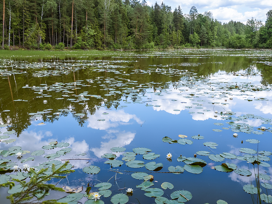
A wetland isn’t always wet
Despite the name, it’s important to understand that not every wetland is a swamp or marsh. Some wetlands can be farmed — or even mowed, like a lawn. According to the EPA and U.S. Army Corps of Engineers, under the Clean Water Act, wetlands are transitional places between terrestrial and aquatic systems.
For the purposes of delineation, a wetland must fulfill a trio of characteristics, says Michigan EGLE:
- Signs of hydrology. While the timing, frequency, and degree of saturation can vary depending on climate conditions, geography, soil texture, human intervention, and other factors, the presence of water is necessary for the development of a wetland.
- Hydric soil. Anaerobic soil that holds excessive moisture also typifies a wetland. This signature lack of oxygen leads to the formation of characteristic hydric soil indicators.
- Water-loving plants. Wetland plants have adapted to survive under excessively wet conditions. The U.S. Army Corps of Engineers’ National Wetland Plant List describes these “hydrophytes” in detail.
Delineating a wetland
In Michigan, the Michigan Rapid Assessment Method for Wetlands (MiRAM) “evaluates the wetland’s ‘functional value,’ which includes a wetland’s ecological condition (integrity) and its potential to provide ecological and societal services (functions and values).” MiRAM assists the state’s Department of Natural Resources and Environment (DNRE), which has limited time for extensive wetland documentation review.
Wetland delineation takes place in two stages. Initial office preparation means an environmental engineer needs to:
- Choose an appropriate date from May-October: Wetland delineation should be performed after the start of the growing season and before the first vegetation killing frost.
- Gather in-office resources for review: aerial photographs, National Wetlands Inventory maps, Natural Resource Conservation Service (NRCS) soil survey maps, etc.
- Determine the approximate topography using all available MiRAM wetland data.
Next, an onsite review requires that the environmental professional:
- Walk the entire wetland, observing the surrounding vegetation
- Take a soil sample and identify it according to wetlands parameters
- Complete a Narrative Rating.
- NOTE: If the wetland is identified as high functional value, the examiner may omit the Quantitative Rating.
- Complete the Quantitative Rating if appropriate.
In summary, wetland delineation will enable a property owner/environmental expert to:
- Map the territory. The research needs to indicate the precise boundaries of each delineated wetland.
- Plant the flag. Just as U.S. astronauts planted a flag to document their lunar landing, you must plant wetland flags to help the permitting authority verify your research.
- Summarize findings. The wetland delineation report needs to include the methods used to delineate wetland boundaries as well as all documentation, including photographs, climate conditions, etc.
Ready to explore the wetlands delineation process for your property or project? TriMedia’s environmental engineers can help. We take an individualized approach to fully understand your project scope and requirements.
- Wetland delineation
- Wetland monitoring
- Wetland permitting
- Wetland restoration